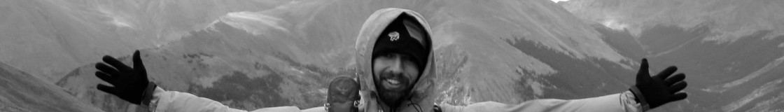
Thru-hiking the Colorado 14ers

I’ve been thinking that someone should thru-hike all of the Colorado 14ers. I’m glad to see that Junaid is planning on doing it. Follow along for his 2013 attempt at 14ersthruhike.com

It’s a logical and ambitious goal. In an adventure world filled with contrived objectives and self-promotion, linking these peaks is a great close-to-home expedition. I especially like three things:. 1) Lots of people bag the 14ers, even in a single season, but no one has walked between them all. 2) Walking between them is much harder (for various reasons) than driving between them. 3) It merges distance power-hiking techniques with an adventure sport that isn’t thru-hiking.

This link-up has been on my mind since my Colorado Trail hike in 2008. As a thru-hiker, it seems like a no-brainer. I had no inclination to do the hike myself though. I’m not much for death-marching. The difficulty of this hike/scramble/climb definitely put it in that category for me. It also requires accepting a level of risk that I’m not willing to tolerate.

Instead, I’ve been telling strong hikers that they should attempt it. It’s one of worthiest hiking 1sts that I’ve thought of. I believe that I even suggested to Skurka that he do it when I saw him at Backpacker in 2011.

Junaid’s proposed route is well worth viewing in Google Earth. It will surely be revised further. His research and field observations are going to include some of the United State’s best hiking routes. Some of them will be little known. Section hikes of his path will be amazing.

I’m very interested in how he will deal with private land issues. Finding a legal way to thru-hike the 14ers is difficult verging on impossible. I’ve also wondered about what style people will use on these attempts. What would unsupported mean? Walk to Post Offices to pick up and drop off climbing equipment? How possible would that be? How about partners on the few technical sections? Free solo?

If you’re interested in Colorado’s 14ers, don’t miss 14ers.com

Wilson, NC and Ocracoke Island

I flew out to North Carolina a few weeks ago to visit my good friend Ben. It’s not often that I can fly across the country to hang out for the weekend. I’m so glad that I did.

We packed up and drove out to the Outer Banks. Ocracoke Island was a surreal experience for me. It’s strange being in such a low-lying, flood prone area. It felt like the ocean could (and does) sweep through regularly. The water table was barely a few inches below street level and it’s like that throughout a huge area.

We had the island mostly to ourselves. It sure was quiet on the beach.

The nice, relaxing ferry rides were an added bonus.

Ben is really into photography so I tried to rekindle it in him.

Of course, the other highlight of the trip was visiting with Ben’s family in Wilson and seeing some of our other friends. We had a mini Utah reunion. Ethan and Kat joined us for an afternoon.

Ben was severely injured in a mountain bike crash in Bolivia. He has a traumatic brain injury. It’s a long, long recovery. His progress is testament to how fucking hard he’s working at it. Remember to visit your friends ok?

Backpacking Ventana Wilderness – China Camp, Pine Valley, Hiding Valley

We made the long drive down to the Santa Lucia mountains last weekend. After a season in the Sierra, I was underwhelmed.

The view of the rugged, and challenging, Monterey District of Los Padres National Forest.

I don’t want to dwell on the negative so I’ll get it out of my system. The trails in Ventana are frequently in terrible shape. Descending from Pine Valley wasn’t much fun. The trail was severely overgrown and the tread was collapsing. If you have the resources, consider helping out. Thrashing through chaparral stinks.

Even though the hiking wasn’t the best, it was still really nice to get out. My little economy car made it down the dirt road to the trailhead just fine. It had snowed about two inches the night before. The crisp air, crunchy trail and fall colors were all very enjoyable. We pulled into camp after meeting a couple of day hikers and two hunters.

I’ve got a new Jetboil and we made a nearly ridiculous number of drinks to relax and warm up. It’s winter and it’s probably time to start having campfires again.

Our camps in Pine Valley and Hiding Valley were really very nice. The first night was under a large pine. The second night will be remembered for the changing maples and shaded Carmel River. Sunday afternoon was enjoyed with a camera, a stretch, a stroll and even more hot drinks.

We slept about 12 hours each night.

Ventana Wilderness backpacking and hiking map

It’s the cool season and it’s time to focus on lower elevation areas.

I haven’t been to Los Padres National Forest or Ventana Wilderness in nearly fifteen years. I think I’ve walked there three times. The longest trip was five days as a boy scout. We went up the Double Cones. I remember a camp where I pulled no less than 14 ticks off my shirt.

Some of the trails in Ventana continue to be in terrible shape. Do your research before you head out! The popular corridor trails (Sykes, Pine Valley) are generally fine. It’s the other trails that can verge on non-existent. This is not the type of bush-whacking that you think you like. It’s thick chaparral and head high poison oak. Think of struggling through sharp bushes where your feet don’t touch the ground. Consider volunteering in Ventana.

Ventana Wilderness maps

The Ventana Wilderness Alliance stewards trail location and condition information on their website. Hikers report on trail conditions in their forum. You can click on Ventana’s trails and get the same trail condition information on their interactive map. More interactive maps on ventanahiking.net, including the great Gmap4 and Google Map (and Earth) basemaps, present the exact same data.

You can download and print this Ventana Wilderness map information too. It’s a good alternative to the Wilderness Press and National Geographic maps.

Unfortunately, you probably don’t want to hike some of these trails.