Category: Backpacking
Backpacking the Palisades Creek Trail to the North Fork of the American River
We were supposed to hike in the Ritter Range but smoke from a large wildfire in Kings Canyon sent us elsewhere. Stressed out from travel and work, I had sent an email Friday afternoon that I was bailing completely. But when I walked out of work at 6 p.m., I figured that since I was already packed, I might as well head to the mountains. The smoke wasn’t as bad near Tahoe and after discussing a few choices, Sim suggested a fairly obscure backpacking trip down the Palisades Creek Trail to the North Fork of the American River.

I really loved swimming above and below Palisade Falls.
It was a short trip. We started late in the afternoon, hiked the seven miles to the North Fork and swam in the outstanding pool at the base of Palisade Falls. After dinner, I read a paper about managing people’s impacts on backcountry trails and hit the sack. This morning we swam a good bit more in the fantastic swimming holes then did a quick hike up and out.
While we’d all been looking forward to our hike outside of Mammoth, this was a nice alternative in the smoky conditions that we had on Saturday. I really enjoyed how much we swam, spending the weekend with friends, and how quick a drive it was.
Everyone has gone back to Sacramento, and I’m typing this up in Truckee. I’m working in South Lake Tahoe this week so I’m going to spend tonight alone, camping along Lake Tahoe and reading a few more papers. It’s time to log off and leave this Truckee coffee shop.
Backpacking the Pacific Crest Trail from Mt. Adams, through Goat Rocks to White Pass
I feel it in my thighs.
We just hiked the Pacific Crest Trail from the South Climb Trail on Mt. Adams, around the mountain, through the forest, up an over the Goat Rocks and all the way to White Pass. It was eight days in the wilderness. My longest stint of the year. The longest trip Lindsey and I have taken together.
And it was utterly groovy.

First, a shout-out to Ali and Colin for being outstanding hiker friends the last three days on the PCT through Goat Rocks Wilderness. It was fun guys. And truly, you made this trip possible by dropping us off at Mt. Adams then days later setting up cars on the northern end, at Walupt Lake and White Pass. PCT section hiking is a mess of impossible logistics. You made it possible.
The Portland portion of vacation was quick: flugtag (flying machines crashing into the river), brewery, Next Adventure (saw PCTers), chores, backyard BBQ, and a comedy show.
Then, hiking. There’s too much to tell and I’m not one for sharing in detail.

Circling around half of Mt. Adams was beautiful. We had nice camps, walked through a large burn area, ran into a friend, and did two side trips. High Camp was very much worth the effort and provided grand views of Adams immediately above, Saint Helens and Rainier. Lookingglass Lake wasn’t. It had burned.
A quintessential sketchy guy, deep in the wilderness, completely unkempt, with a machete, gnarly infected eye and a you-wouldn’t-believe-it charming and nice demeanor, gave us mushrooms on the shoulder of Mt. Adams. We ate those King Boletes and they were delicious with couscous.
As often happens, we slept a lot. Wonderfully long naps. Early bed times. Late starts. Walking 10 miles per day is really darn pleasant. I also read a book (What is the What?), usually with Lindsey cutely reading snippets over my shoulder instead of doing math or reading scientific papers.
I really like section hiking the PCT. Yes, i’ve seen it all. But it’s oh so nice to return to familiar places.

On our fifth day, I swam, read, relaxed, ate the crumbs of my food bag and twiddled thumbs long enough to start to worry. Then, Ali and Colin finally walked up to our backcountry lake, with the food and smiles we were expecting. Whew.
From there on, it was the heart of Goat Rocks Wilderness. It’s for that scenery that I flew up to the northwest. On my thru-hike, I had decidedly mixed conditions through the area. Partly cloudy skies, then rain and fog. This time, wonderful blue skies and puffy clouds dominated. We had one of the most epic PCT camps that I’ve had with full views of Mt. Adams, Saint Helens, Rainier and Goat Lake. We climbed to the summit of Old Snowy and I walked the Old Snowy alternate as well as the actual PCT. Then we hit the iconic Knife’s Edge and did the still very enjoyable miles down to White Pass.
I gave my conditions report to my coworker who is in charge of the area and it was full of details. The major bits were: a bit of ATV incursion near Potato Butte, generally excellent trail, mild brush above Walupt, still incorrect signage on the alternate on Old Snowy, really bad tread collapse on the Knife’s Edge, and the wonderful experience of walking northbound right after logout and new trail around Shoe Lake. Also: every camp had an actively used fire ring, usually far too close the the trail, and during a fire ban. And, too much toilet paper from people that buried it an inch deep, plus multiple outright surface turds. Remember to teach newbies pooping and make sure they comfortable with doing it right.

We woke up to clean legs after this. And I guess, dirty sleeping bags. Still, she wouldn’t even jump in the lake before we got on the plane home. My kind of girl.
Backpacking McGee Pass to the Lee Lake and Cotton Lakes region
We ate wild onions and hiked short bits of cross country. We swatted mosquitoes and swam under cloudy skies. We talked and relaxed and explored.
Two years ago we backpacked Lewis Lake in Emigrant Wilderness. This weekend my uncle and I drove out to McGee Creek Trailhead on the east side for another summer trip. I’d been here before, with a broken shoulder, on a trip with Charlie in 2009. He carried most of my stuff to Iva Bell and Devil’s Postpile.
It was a quick turnaround from last week. Five days at work and then a Friday afternoon drive back to Inyo National Forest. Bill and I got started early and made it up and over McGee Pass our first day. I utterly crashed, sleep deprived, once we made camp. I sleep so well outside. I can nap before dinner then go back to sleep once the first star comes out. It’s glorious.

I love this view. It’s pretty much the reason that I wanted to do McGee Pass again. Traveling back to the car it started to rain while we were on these switchbacks. The rocks were even more amazing when wet.
Sunday, we hiked from Lee to Cecil Lake then back to pack up camp. I found some obsidian tools.
Dropping down into the Fish Creek drainage, we walked another one of those scarcely traveled Sierra trails. From Tully Lake we explored for a short while up in the Cotton Lakes area. We took a dip in the biggest of the lakes, then packed up with clouds overhead to boot it back up and over the pass.
It was my vote to position ourselves closer to the car so that I’d get home a bit earlier on Monday. Crossing back over McGee Pass it started to rain. Low clouds were gathering further down the Silver Divide. Rain gear on, a nip of bourbon, we walked slowly, savoring it, down to Big McGee Lake. We pitched tents and I fished.

One of the dozen or so lakelets in the Cotton Lakes area.
On the drive home I picked up four hitchhikers. Three were PCTers and the fourth was a local. Two of them rode with me from Lee Vinning to South Lake Tahoe. Darn good people.
Darn good trip. Darn good time with Uncle Bill.
Uncle Bill likes to think that he’s slow but he’s really not.
Backpacking Italy Pass, Bear Lakes, Seven Gables Lakes, Three Island Lake and Hillgard Branch – John Muir Wilderness
I’ve been dreaming of this trip for a decade or more. And planning it for two or three years. It was as good as I hoped it’d be.
We spent six days in the backcountry, walked 42 miles, did 10,000 feet of gain and generally slept above 11,000 feet. We saw forty lakes, few people (except on the PCT), walked cross country and scarcely-there trails, swam, took photos and fished.
The forecast when we were heading out was bad – 60% chance of thunderstorms. We lucked out for the first four days, then got slammed as we were exiting back over Italy Pass. Around 2pm, I paused the group for a snack and to assess the dark slate clouds. My vote was to wait and see what developed. After a while, we walked on. We ended up sheltering amongst boulders, in lightning position, three times as the sky flashed and hail rained down. The weather had turned and mostly stayed wet all the way to the car the next day. For the last hour, I took my rain jacket off and walked in the storm like I was in the tropics. What a way to feel connected.

Charlie looking down at Bear Lake and Ursa Lake. Seven Gables and Gemini are in the background.
The other weather worth mentioning was that I saw the start of a tornado. Directly above our heads at Seven Gables Lakes a thunderhead had a spot that started swirling. It was a tight little whirl. Beautiful and stunning. But oh, thank goodness that it dissipated and never dropped a twister. Don’t know what I would have done if it had.
It was darn nice to have plenty of time in the high alpine basins. Without mileage goals, we explored the area more fully than I otherwise would have. Depending on how I count it, we walked in nine distinct areas.

Dani caught a fish at one of our favorite lakes with tenkara gear.
We camped at lakes most nights, but there was one on our route that was truly special and on the list to return to. It’s swimming heaven and I want to carry in floaty toys next trip.
Other things of note:
- My food was good because I used my dehydrator a lot. Most meals had 10+ ingredients.
- The Sierra High Route passes through the area we played in. I haven’t hiked that section of the SHR yet (I’ve been most places on it and completed ~60% of the route) but again, I’ve confirmed for myself that it’s a path that is ridiculously hard work. I don’t think most people realize how much effort the SHR is.
- All three buddies take really fantastic photos. I bought a new point-and-shoot camera before this trip and my pictures are pretty nice too. I tend to take more people and documentation pictures and fewer landscapes.
- My previous trip in the area (to upper French canyon and Royce Lakes in 2009) was done solo, with a broken shoulder and only a fanny pack to carry overnight gear. That was wacky.
- Tenkara fishing was fun, but only moderately successful. I caught one small fish and hooked a few others.
- The July storm dropped a surprising amount of hail and snow. It even closed Tioga Pass for a bit.
- Charlie hiked in Vibram Five Finger shoes again. Like last trip. He’s crazy.

Snapping a photo with fresh hail on the ground. I was in lightning position again about ten minutes after this picture was taken.
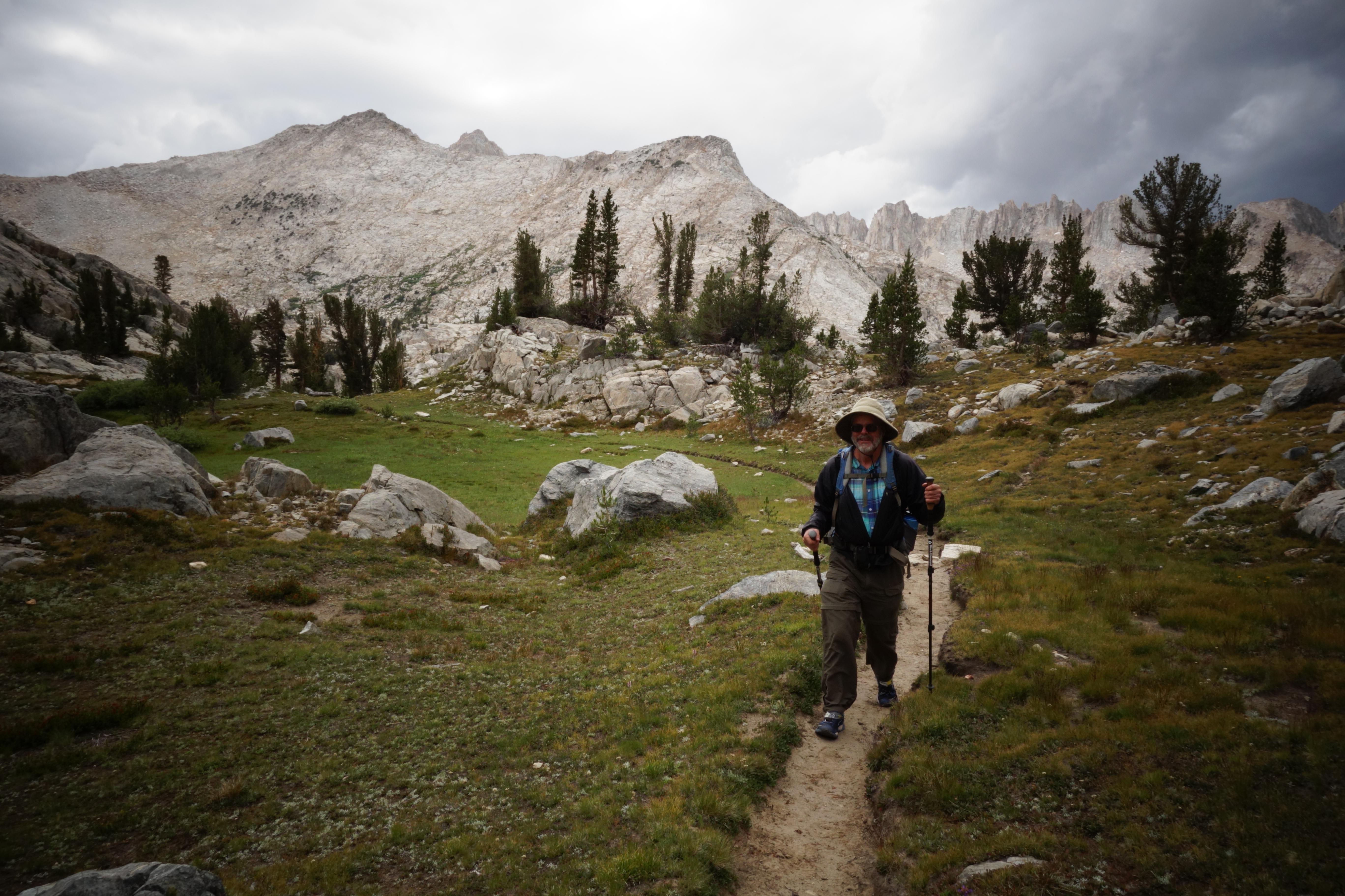
Backpacking the Red Peak Stock Trail, Lake Schmidell and Rockbound Pass in Desolation Wilderness
I might be too tired to be writing. Lindsey and I just got home from a loop up in Desolation Wilderness.
We left on Friday after post-work barbeques and camped by the side of the road not too far from the trailhead.
In the morning, we chatted up some Forest Service staff who were out repairing the Barrett Jeep Trail. While they were intimately familiar with the area, they didn’t know where the Red Peak Stock Trailhead was. It’s that obscure and rarely traveled. Not totally confident that we’d find our trail, we hiked up the jeep trail to find it anyways. Anyone that’s a competent navigator should be able to find and follow the Red Peak Stock Trail. Sometimes faint, sometimes only cairned, we had little problem following it and I found it to be fun and beautiful. It’s really neat to be so high on the crest that dominates over the central valley.

Wildflowers were diverse and plentiful. Probably at their peek.
Camp at Lake Schmidell was made somewhat early and I took advantage of it by napping the day away. Beyond drooling on my pad, we swam, ate and talked science. We’d planned on going for a larger loop, but neither of us really wanted to do all of that walking.
Today’s start was late and leisurely. A welcome cloud cover made hiking all the more enjoyable past Lake Lois and Doris. At lunch (tabouli again – delicious) it started to rain. Being a multi-year drought, that’s really damn nice.
