Tagged: backpacking
Backpacking the north rim traverse of Yosemite Valley
We took Friday off work and went backpacking along the north rim of Yosemite Valley. This was one of the trips that we’d planned back in January. While climbing up from the trailhead at Big Oak Flat Road, I realized that this summer marks 25 years backpacking. It’s a hobby that’s here to stay.
We did the drive Thursday night and had an extended dinner at Priest Station. Camp at Crane Flat is remembered because a thunderstorm had clearly unleashed a torrent not long before we arrived.
After permit pickup at the wilderness office in the valley, and the rigamarole of coffee, bathroom, parking, packing and shuttle, we hitch hiked very easily with a brother and sister. He was heading to work outdoor education in Marin.
We split our hike into three perfectly even days. Night one on El Capitan. Night two on North Dome. Backpacking the north rim is all about the iconic, epic, views of the cliffs of Yosemite.
The trip felt marked by Half Dome. We were always walking closer to it. I also felt a strong sense that Yosemite was a bit smaller than I’d thought it to be. I could see a good bit of the park. Places I’d been. And they didn’t look far away.
At both campsites, I felt encroached upon by foreign tourists. An Italian and a German choosing to camp forty feet away the first night. A troop of Chinese photographers that night hiked in and set up tripods the same distance from my sleep spot the second night. Sure, these are famous places. But there was plenty of space and they were needlessly close. American wilderness ethics, and LNT, are not widely engrained.

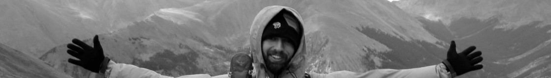
Hanging out at my sleep spot on the summit of El Capitan.
We saw a bear. A small, light colored yearling running away. We summited Eagle Peak and I detoured to Yosemite Falls. Between the famous locales, the trail was mostly quiet. For being the north rim traverse of Yosemite’s famous valley, it seemed like it was a hike that’s somewhat rarely done.
The stream before North Dome wasn’t running and since we were dry camping, I walked back twenty minutes to gather two gallons from the creek before it.
After the big descent down the rim along Snow Creek, we lunched at Curry Village and swam in the Merced. All in all, a wonderful trip.
Backpacking to Caribou Lake in the Trinity Alps
Storms were hitting the Sierra Nevada but farther north was dry so that’s where we headed for Memorial Day weekend.
I’ve taken to watching hashtags of place names for conditions reports. Before the weekend, two people had posted recent photos of the high country. After the weekend, dozens and dozens of photos went up. Summer has started.
As it tends to happen, we had a great time in the mountains. I’m more relaxed and all ready to go back. This felt like a good kick off to another hiking season.
The trailhead at Big Flat is a long way out. Nearly three hours from Redding. Once we left Highway 3, it was a solid hour down Coffee Creek Road, more than half of that on dirt.
The Caribou Lakes are popular. We shared the basin with probably 15 other groups. Lindsey and I made camp high up and away from most of them and had a great view. We stayed two nights. Sunday sent us exploring and finally up the pretty steep snow to Sawtooth Ridge. We’d considered dropping down and looping around to Big Flat but opted-out. The view down the Stuart Fork and across to the mountains all around was fantastic.

The view from Sawtooth Ridge in the Trinity Alps. Still plenty of snow in the high country.
Other things? We read issues of the New Yorker. Ate dinner late. Nipped some bourbon. Talked about all of the campers below.
The Trinity Alps have a fantastic conditions report that’s stewarded by the Wilderness lead. You can see it on the Shasta-Trinity National Forest homepage. It talked about the severely limited trail maintenance dollars in the area. I did a bit to help the situation on my way out by clearing hundreds of sticks and stones, a few trees and fixing drainage issues. It made for a fun day. We also split off the main route and hiked the Caribou Gulch trail down. As expected, it needed even more repair but was still very passable and a nice way to go.
Backpacking the Circle of Solitude

We hiked about 75 miles and climbed about 16,000 feet.
Up, up, and away.
Charlie, Dani and I huffed and puffed around the Circle of Solitude in five days. It was hard, beautiful and a lot of fun.
Avalanche Pass kicked my butt. Cloud Canyon felt like an achievement unlocked. Colby Pass, crossed at six pm, was a highlight. We’d pushed hard and the view was worth it. Standing up high on the Great Western Divide, looking down towards the Kern Trench, and across towards the Kaweahs, ready to drop down another five thousand feet.. it was a very physical trip.
We pushed up to the headwaters of the Kern, a basin I was thrilled to return to and can’t wait to visit again. Clouds joined us at Lake South America, but they felt more like the edge of a system rather than a growing cumulonimbus.
Day four brought us cross country to Harrison Pass. Being early July, we didn’t know if the chute would be covered in snow and ice. It wasn’t. We still turned around. Dang, that descent looked dangerous.
I don’t have a very high tolerance for risk. Harrison is your typical avalanche chute. Steep, featureless, loose. Below the top, there was no evidence of prints. No indication of a safe way. It looked like as soon as you were on the face you could slip. I can only guess that winter slides have changed the route since the guidebook recommended it. We turned around and started a long day over Forester instead.
I’ve wanted to do this loop for a dozen years and I’m very glad that my best buddies huffed along.
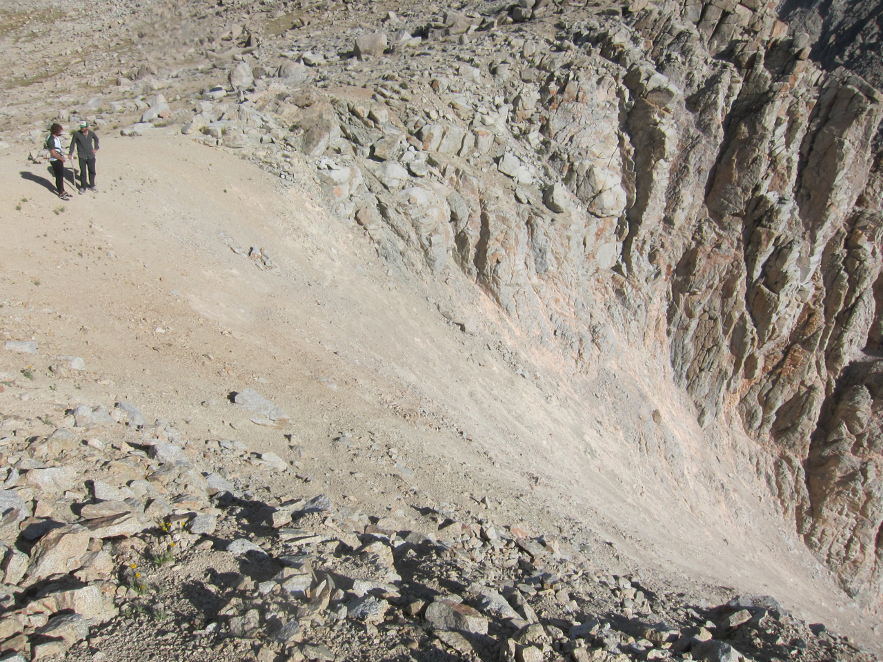
Falling on the first 40 feet seemed probable.
Planning an Appalachian Trail Thru Hike is easier than doing one.
It’s outrageous, but planning a 2,100 mile hike along the Appalachian Trail is easier than most things that you do.
Step 1: Buy the AT Guide: I recommend getting it loose-leaf. Take out the first quarter, give the rest to a friend to mail to you when you need it.
Step 2: Buy a plane ticket to Altlanta, Georgia.
Step 3: Reserve a shuttle to the trailhead.
Step 4: Buy 2-4 days of food. I bought two lunches, two breakfasts and two dinners.
Step 5: Pack your pack and go!
Pacific Crest Trail Video
In 2006, I walked the Pacific Crest Trail. It was hot dang wonderful. Since then, I’ve found myself building a sizable collection of videos on youtube. I thought that I should revisit my PCT hike, since I had little visual documentation of it (an epic tomb of words can be found on this journal.) It was really enjoyable to search back through my photos of the trip. Most of my content on youtube features actual moving images. I hadn’t explored making slideshows. Aren’t those antiquated? Aren’t I more modern? And yet, a slideshow, 2006 technology one might say, was made. The process inspired me to go back through some of the 21,000 photos on my ibook. Perhaps there will be some more slideshows to come. Myanmar definitely deserves it.
A CDT slideshow can be seen by digging a little into my online presence. hint, hint..
