Tagged: pacific crest trail
GPS Track and Waypoints of the Pacific Crest Trail
Hey Community!
I’d just like to too my own horn a little. Toot-Toot!
The current issue of Backpacker Magazine, February 2007(!) has a short interview with me in it. It’s titled “The PCT Project”. They hooked me up with a GPS, some shoes and socks and funding to hike the trial this summer. In exchange, I kept the GPS on all of the time and recorded waypoints and a track log of the whole trail.
Every 40 feet or so the unit recorded a bread crumb and every mile or so I recorded a waypoint. Waypoints are points of “interest”, so deemed by yours truly. Mostly, waypoints are the water sources, trail junctions and roads along the trail. Some pictures that I took will be attached to the data. The magazine blurb is in print but the data hasn’t been posted yet. Hopefully it will be in then next few days. You’ll see it at backpacker.com/hikes
It’s a pay website ($15/year). But there is a 90-free trial, during which you can download the track and the Google Earth file. Funny thing is, the whole PCT is far too big to load in to a GPS unit. There goes your hopes of hiking the trail with a GPS crutch huh? Luckily, as someone that HAS hiked the PCT with GPS, I can confirm that it’s truly NOT necessary. What this project does provide, is a new detailed track and more importantly a waypointed track! Trust me, it’s super cool when loaded in to Google Earth. And it doesn’t have the weirdness of the Forest Service track which thinks that we want to view the hike southbound.
To you avid thru-hikers, some of the interview might make be seem like a bozo. Trust me, I am. But understand that a magazine interview such as this is largely “paraphrasing” from a long conversation. Still, I’m really happy with the end result. I spent a week in Boulder with the Map staff. They’re top notch and doing some cool GPS mapping of the states. The AT was also (hopefully) mapped this year and they’ve got an interesting project for the CDT next year. I STRONGLY encourage the long distance hiking community to look in to the CDT project. It’s introduced in this same issue and you can sign up for the project (if you so choose) at backpacker.com/cdtmap
So,
– I’ll write again when the track is actually online.
– First person that finds a spike off the trail (which marks a spot where I hiked off to go to the bathroom), gets a fresh, steaming pile of poo via Priority Mail.
– First person that actually uses this track, better give me feedback!
Kindly,
Jack “Union” Haskel
P.S.: Like many hikers in ’06, I skipped a burning section in Oregon around Mt. Jefferson. So there’s a 50+ mile gap in my life which I hope to hike and GPS next summer.
Post Hike thoughts
Hey Friends!
I hope everyone is great. I mean really, really great. I’m just writing to keep in touch…
Hmmm… It’s been almost two months since I finished. What have I done? Um, not much. heh. I’m living at home in SF which is pretty nice. I eat well on my parents dime and have very low expenses. I’m trying to keep in good shape but the huge portions that I continue to eat are giving me a nice bit of pudge.
I really went through (am going through) a good bit of reentry regrets. Damn I wish I was still hiking. Lucky for me, I have no job so I do actually get out and hike. I went backpacking right away in the local oak woodlands (Ohlone Wilderness), did another backpacking trip out at the coast (Point Reyes) and went car camping down at this cool ancient volcano (Pinnacles). Keeping sane I guess. San Fran is pretty damn far from the Sierra though and I’m missing it badly. I’ll hopefully head up there soon. I’m still GPSing all my hikes. The first one I didn’t log and every time I got to a gate or a trail junction, it felt strange to not stop for a waypoint. Count another future CDTer here too.
Backpacker told me that if I submit some more trips, they’ll exchange my GPS for a GPS cellphone with minutes that I can use. That’d be nice. I spent a week in Boulder sorting through the data. The project has turned out to be pretty damn cool. And yes, you can actually see some of the times that I walked off trail to take a crap  Even funnier though is that the track is too damn big to be of much practical use. You can’t load it in to a GPS!! People, if they so choose, will be able to load sections but not the whole thing. But you can load it in to Google Earth and see the pretty detailed waypoints (turn left here, nice shady oak there, great views over that way, etc). It should be up online sometime in December on backpacker.com/hikes. It’s a pay website ($15/year), but you can sign up for a free trail and download the PCT during that time. There is also a little piece (“The PCT Project”) in the magazine introducing the map and myself. It’s going into the February issue (which comes out in December). I’ll spam the PCT-L and the yahoo group when it goes online.
In the “not great” department, my feet have stayed bigger. Meaning, many of my old shoes don’t fit! Damn it! Has this happen to anyone else? I’m definitely buying new snow boots but will try to hold off on the other sports. My feet are pretty unhappy in my bike shoes though.
On the job search front, there seem to be some cool ones in this world. I’m going for those. I haven’t heard back from anywhere yet though  I’m pretty much applying to most of the “core” companies and associations in the backpacking universe. I spend my days applying to places all over the country.
When you come to the city sometime in the future, drop me a line. We’ll do something fun!
Cheers,
Jack
The Official PCT around Glacier Peak
Re: trail maintenance in Glacier Peak
Having just hiked the “impassable” section I can shed some light. It’s my understanding that the Forest Service is planning on repairing the trail (there is a sign at the end of the detour that says that they’re currently working on it). It’s understandable though that it’s going to take years, if it’s even possible. First, the Suiattle River needs to be bridged. How it’s possible, I don’t know. The river isn’t big right now but the flood wash around it is about 500ft (?) wide. That’s a HUGE bridge. The other bridges could more easily be repaired but each one will be quite expensive and prone to future destruction. Then there is an area of switchbacks that was washed away in a landslide. It’s a fairly big zone of loose soil and rocks. A large scar down the entire ridge. This obstacle will probably require some re-routing of the trail. For them to do that while still maintaining the slight incline of switchbacks might require moving the whole trail a bit or a lot. I’d be surprised if they could simply rebuild trail accross the active slide path.
The trail is doable as evidenced by the hikers passing through. The danger areas that I identified were the crossings of Whitechuck Creek (I think), and the landslide area. We crossed Whitechuck on a somewhat sketchy log over dangerous water (this was upstream of the destroyed bridge). I heard that there was a better log downstream if you follow the flagging.
The oft-talked about Suiattle River crossing was fine. When we passed through there was a large tree just barely bridging the river downstream of the trail. It’s a constantly changing stream bed though and this log seems to be on it’s way out. I won’t give away the surprise but this log crossing is a novelty. When I passed through, fording the Suiattle seemed in the realm of the possible. Again, dangerous, but possible. It was maybe knee deep, pretty swift but not totally cloudy. The runout of a swim looked decent.
Our route through the landslide was more dangerous than neccessary. It involved some slight, loose mud footholds on very high angle slopes with dangerous consequences. It was better to simply head straight down the slide path for a little bit. Be sure to scout!
All in all, the trail was great. Beautiful and exciting. But be aware that the old trail did involve a greater degree of risk than most of the rest of the PCT held. It was one of the most dangerous things I did on the trail this year. The government has flagged helpful areas. Follow this flagging.
I mitigated the risk by not traveling solo through this section. I suggest you do the same. I’d also seriously consider taking one of the alternates. I’m sure they’re great and they probably safer. Safety is #1 priority, right? So, make up your own mind. I don’t recommending heading in to this area simply because other hikers are doing it.
I have thruhiked the PCT
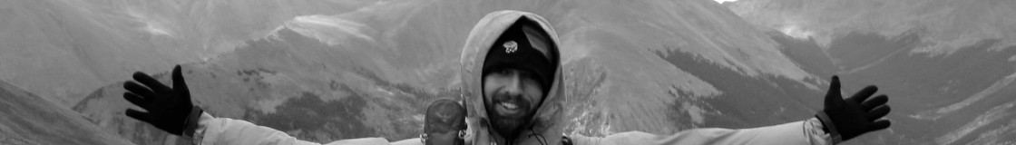
I’m done! Wooooooohoooooooooo! more to come later. It’s been a fantastic trip. Super fantastic.
Life continues but the trail stays within.
Southern Washington on the Pacific Crest Trail
Hello from Seattle!
I’m in the city with Snail and Hot Sister, staying at Hottie’s wonderful mother’s house. Just heard Snail say that he has gained eight pounds since he arrived here yesterday. Personally, I’m down to a slight 130 pounds. I think that I started the trail at 142 and considering that I weighed 165lbs before I became a vegetarian, I can confirm that thru-hiking is an excellent weight loss plan.
The trail continues to be great. Washington is going well. The first few days out of Cascade Locks were a little brutal as I had a very heavy pack, the trail gained and lost a lot of elevation (with no views as rewards) and it was very hot and humid. Thankfully that transitioned into something better. I passed areas dotted with multitudes of lakes, ridges with catastrophic views of the area’s Stratovolcanoes (Adams and Rainier), and other great alpine scenery. Goat Rocks wilderness is cited by many to be a highlight of the hike. It surely did not disappoint. Goat Rocks rocks! It’s very, very beautiful. Walked down a sketchy knife edge ridge in a near white out, saw about 50 Mountain Goats, was shaken to the bone by some sketchy ice traverses,…
Since Portland I’ve also been hiking with some of my favorite people. Snail, Hot Sister, Pouch, Nemo, just to name a few. The hiking community has really made the hike. Love to all that I’ve met!
The end of the trail is on fire and therefore closed. Epic year for fires it has been. Off the top of my head I think that there are seven major forest fires that have either threatened or burned the trail this year. It’s a little frustrating that I won’t be able to walk to Canada on the PCT, won’t get to take a picture or sign the register at the end monument, but whatever. It’s about the journey, the finish line would be anti-climatic anyways I’m sure. Plus the alternate route sounds pretty nice. I’m hopefully headed back to Oregon to do the 57 miles around Mt. Jefferson that I skipped due to fire once I get to Canada anyways. Would like to go to ALDHA-W but I’m probably reaching to border on Sept. 29th and that would be too late.
I’m excited about this next section. Alpine Lakes Wilderness is supposedly beautiful. Lots of climbing but great rewards. Hopefully the weather holds and hopefully I don’t pull another stupid stunt like sleeping in a depression during a rain storm. Hah!
