Tagged: triple crown
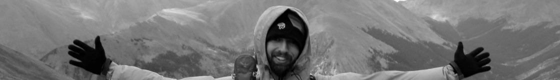
The Sendoff!
I’m leaving this evening. Guests are coming in an hour for a backyard
bash of falafels and wine. My pack is strewn around the back room. My
backup gear needs to be thrown in a box. I’m still loading my GPS, and
I just bought a new camera. Talk about last minute.
Tonight I fly to Seattle and then on to Spokane. I’ll take a taxi to
the train station for the 1:30am ride to East Glacier. I expect that
I’ll meet other thruhikers on the train platform. Can’t wait to rejoin
the tribe!
Tarptent Moment Initial Review
The Easton, blue, short stakes that tarptent provides are garbage.
I’ve broken about half of the ones that i’ve used and won’t rely on
them ever again. Personally, I suck it up and carry Y-Stakes. They’re
worth their weight. I also use rocks if needed. And I LNT to a high
level for sure.
I haven’t used the Moment yet. I’m bringing it tomorrow on my CDT
hike. Pushing on it’s weak points with my hands (a great test for
tents), it seems weak in the wind. i’ve tied extra cords on the
attachment points to avoid a collapse. I plan to carry six stakes for
it as well. I’m still concerned about it’s windproofness though.
And here I set out, in what I anticipate to be harsh weather.
Hopefully this tent works out!
The final, final preparations for the CDT.
Whew. It’s my last night in town, and I’ve pretty much given up. I’ve
done enough. I’m ready to go out with friends and not worry about it!
The last major things that I haven’t dealt with yet include loading
maps and tracks on my GPS. I’m sick of that project, screw it!
I’ve also got to buy a new camera. Not happy with the one that was
supplied. I’ll walk up the street and buy one at the local photo store
tomorrow. Other than that, my maps are packed. I’ve got food ready for
Canada to Helena. And then another box to Sula Country Store. I
wrangled my grandmother and my uncle into sending me a box a piece.
Food of their choosing. That’ll be interesting!
GPS Track and Waypoints of the Pacific Crest Trail
Hey Community!
I’d just like to too my own horn a little. Toot-Toot!
The current issue of Backpacker Magazine, February 2007(!) has a short interview with me in it. It’s titled “The PCT Project”. They hooked me up with a GPS, some shoes and socks and funding to hike the trial this summer. In exchange, I kept the GPS on all of the time and recorded waypoints and a track log of the whole trail.
Every 40 feet or so the unit recorded a bread crumb and every mile or so I recorded a waypoint. Waypoints are points of “interest”, so deemed by yours truly. Mostly, waypoints are the water sources, trail junctions and roads along the trail. Some pictures that I took will be attached to the data. The magazine blurb is in print but the data hasn’t been posted yet. Hopefully it will be in then next few days. You’ll see it at backpacker.com/hikes
It’s a pay website ($15/year). But there is a 90-free trial, during which you can download the track and the Google Earth file. Funny thing is, the whole PCT is far too big to load in to a GPS unit. There goes your hopes of hiking the trail with a GPS crutch huh? Luckily, as someone that HAS hiked the PCT with GPS, I can confirm that it’s truly NOT necessary. What this project does provide, is a new detailed track and more importantly a waypointed track! Trust me, it’s super cool when loaded in to Google Earth. And it doesn’t have the weirdness of the Forest Service track which thinks that we want to view the hike southbound.
To you avid thru-hikers, some of the interview might make be seem like a bozo. Trust me, I am. But understand that a magazine interview such as this is largely “paraphrasing” from a long conversation. Still, I’m really happy with the end result. I spent a week in Boulder with the Map staff. They’re top notch and doing some cool GPS mapping of the states. The AT was also (hopefully) mapped this year and they’ve got an interesting project for the CDT next year. I STRONGLY encourage the long distance hiking community to look in to the CDT project. It’s introduced in this same issue and you can sign up for the project (if you so choose) at backpacker.com/cdtmap
So,
– I’ll write again when the track is actually online.
– First person that finds a spike off the trail (which marks a spot where I hiked off to go to the bathroom), gets a fresh, steaming pile of poo via Priority Mail.
– First person that actually uses this track, better give me feedback!
Kindly,
Jack “Union” Haskel
P.S.: Like many hikers in ’06, I skipped a burning section in Oregon around Mt. Jefferson. So there’s a 50+ mile gap in my life which I hope to hike and GPS next summer.
The Official PCT around Glacier Peak
Re: trail maintenance in Glacier Peak
Having just hiked the “impassable” section I can shed some light. It’s my understanding that the Forest Service is planning on repairing the trail (there is a sign at the end of the detour that says that they’re currently working on it). It’s understandable though that it’s going to take years, if it’s even possible. First, the Suiattle River needs to be bridged. How it’s possible, I don’t know. The river isn’t big right now but the flood wash around it is about 500ft (?) wide. That’s a HUGE bridge. The other bridges could more easily be repaired but each one will be quite expensive and prone to future destruction. Then there is an area of switchbacks that was washed away in a landslide. It’s a fairly big zone of loose soil and rocks. A large scar down the entire ridge. This obstacle will probably require some re-routing of the trail. For them to do that while still maintaining the slight incline of switchbacks might require moving the whole trail a bit or a lot. I’d be surprised if they could simply rebuild trail accross the active slide path.
The trail is doable as evidenced by the hikers passing through. The danger areas that I identified were the crossings of Whitechuck Creek (I think), and the landslide area. We crossed Whitechuck on a somewhat sketchy log over dangerous water (this was upstream of the destroyed bridge). I heard that there was a better log downstream if you follow the flagging.
The oft-talked about Suiattle River crossing was fine. When we passed through there was a large tree just barely bridging the river downstream of the trail. It’s a constantly changing stream bed though and this log seems to be on it’s way out. I won’t give away the surprise but this log crossing is a novelty. When I passed through, fording the Suiattle seemed in the realm of the possible. Again, dangerous, but possible. It was maybe knee deep, pretty swift but not totally cloudy. The runout of a swim looked decent.
Our route through the landslide was more dangerous than neccessary. It involved some slight, loose mud footholds on very high angle slopes with dangerous consequences. It was better to simply head straight down the slide path for a little bit. Be sure to scout!
All in all, the trail was great. Beautiful and exciting. But be aware that the old trail did involve a greater degree of risk than most of the rest of the PCT held. It was one of the most dangerous things I did on the trail this year. The government has flagged helpful areas. Follow this flagging.
I mitigated the risk by not traveling solo through this section. I suggest you do the same. I’d also seriously consider taking one of the alternates. I’m sure they’re great and they probably safer. Safety is #1 priority, right? So, make up your own mind. I don’t recommending heading in to this area simply because other hikers are doing it.
